University of Richmond’s Transboundary NASA SERVIR Amazonia Workshops combine Indigenous Knowledge, Scientific Analysis, and Geospatial Technology for a Sustainable Future
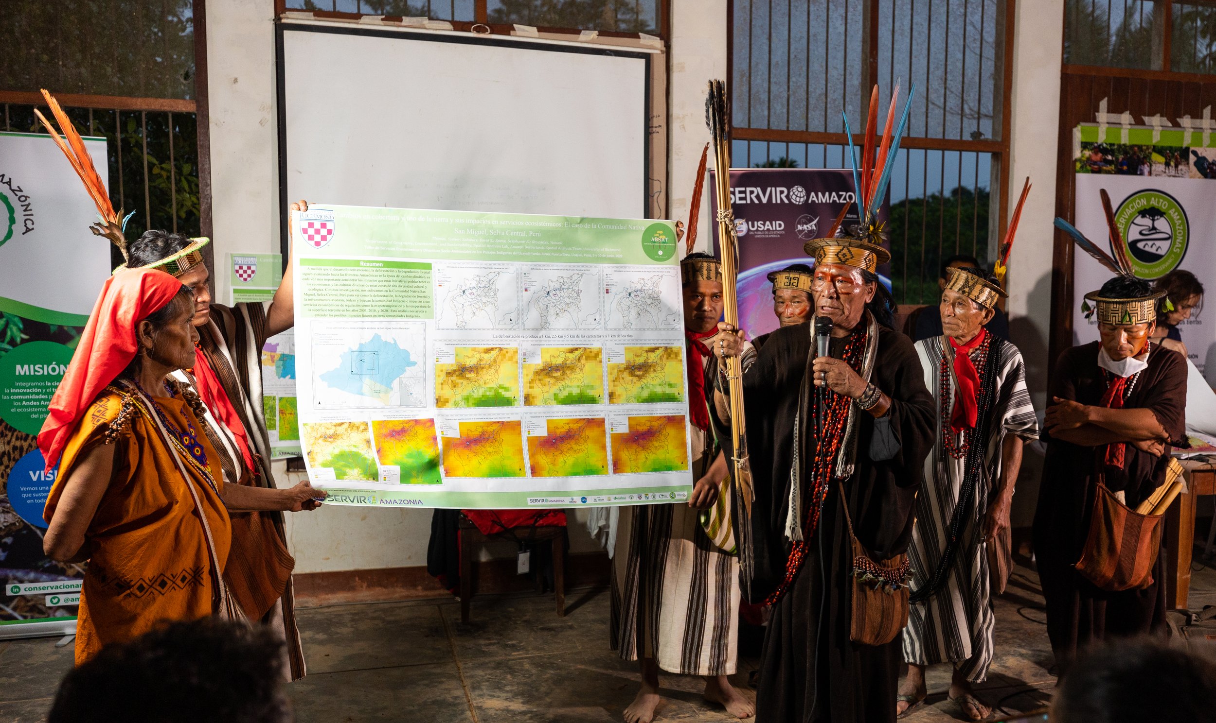
The University of Richmond’s Amazon Borderlands Spatial Analysis Team (ABSAT) led two transboundary workshops near the Peruvian and Brazilian border in 2022. The first, Ecosystem Services and Socio-Environmental Dynamics in the Indigenous Territories of the Ucayali-Yurúa-Juruá, worked with 120 Indigenous participants and SERVIR-Amazonia, NASA, ACCA, Upper Amazon Conservancy, ACONADIYSH, OPIRJ, Apiwtxa, and UFAC-Campus Floresta to combine expert Indigenous knowledge, scientific analysis, and geospatial technology to help plan for a sustainable future in the Juruá-Yurúa and Ucayali watersheds across the Peruvian and Brazilian Amazon borderlands.
The second, Workshop on Transboundary Corridors and Ecosystem Services in the Southwestern Amazon, hosted by the National University of Ucayali (UNU) included over 40 participants from 19 governmental, non-profit, academic, and Indigenous organizations from Peru (Ucayali, Madre de Dios, and Lima), Brazil (Acre), and the USA. This NASA SERVIR Amazonia workshop trained the participants in Geo-Dashboards developed by ABSAT, updated a shared transboundary database, and built a suite of transboundary maps on climate, forest disturbances, and protected areas.
SERVIR-Amazonia, a collaborative initiative of NASA and USAID, seeks to improve local capacity through the use of geospatial technology for the conservation of the Amazon. The Applied Science Team Spera (ABSAT) of the University of Richmond connected Space to Village in these two back to back workshops focused on local Amazonian partners.
Please see the video links with Spanish or Portuguese subtitles.